What Is Counter-UAS Radar?
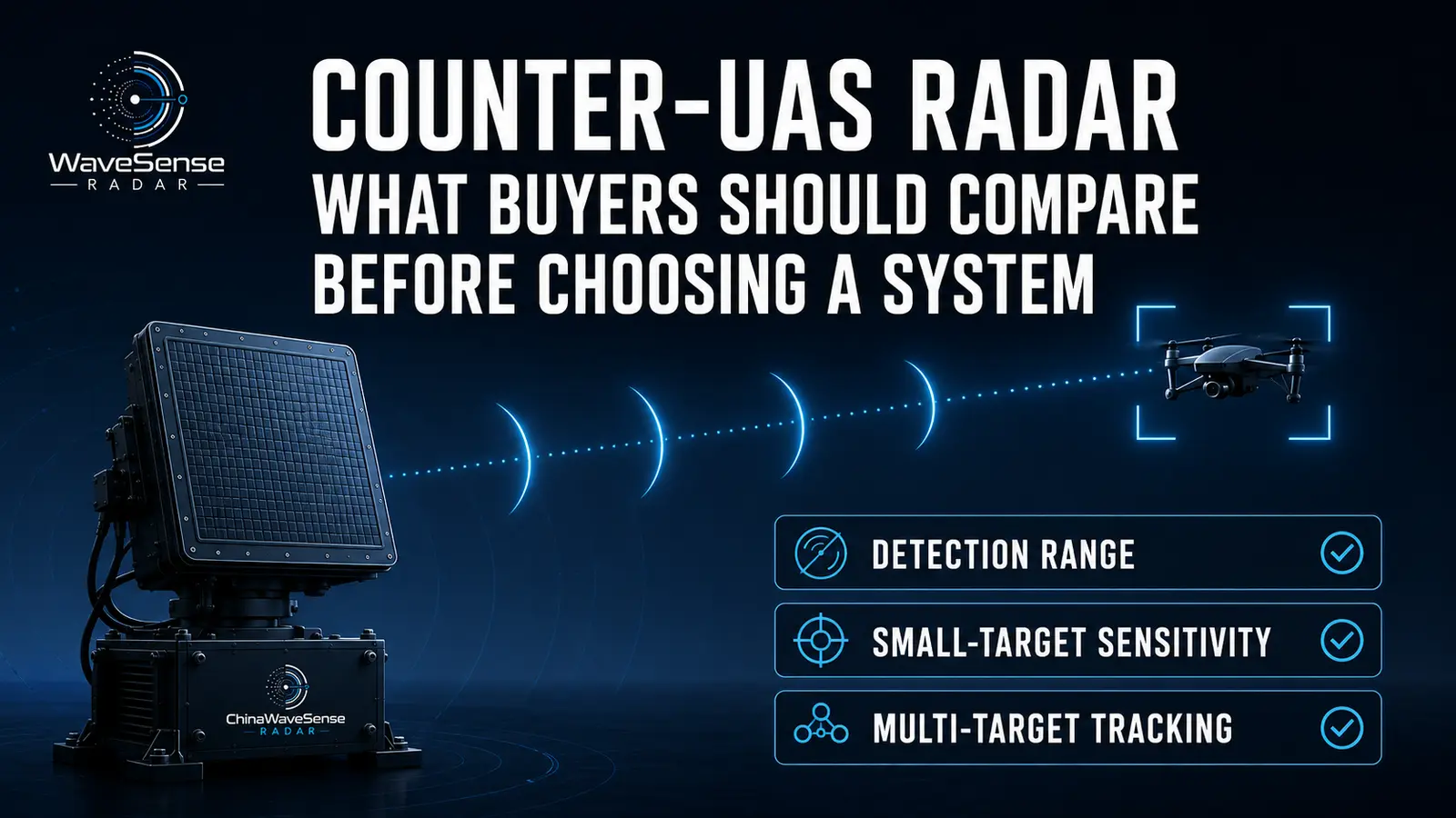
Counter-UAS Radar is a radar sensor designed to detect, track, and help classify unmanned aircraft, but the best system is not the one with the longest advertised range—it is the one that reliably detects the required UAV under defined RCS, altitude, clutter, update-rate, and false-alarm conditions.
A professional radar must do more than display a drone icon.
It must continuously convert weak radar returns into usable target information for operators, cameras, RF sensors, command systems, and other authorized response systems.
What Does C-UAS Mean?
C-UAS means Counter-Unmanned Aircraft Systems.
The term can describe a complete architecture used to:
- Detect
- Track
- Identify
- Assess
- Respond to unauthorized UAS
Radar normally performs the physical detection and tracking part of that architecture.
A radar by itself should therefore not automatically be described as a complete Counter-UAS system.
Current C-UAS frameworks commonly separate the mission into detection, tracking, identification, and mitigation functions.
Is Counter-UAS Radar The Same As An Anti-Drone System?
No.
Counter-UAS Radar is normally one sensor.
An Anti-Drone System may combine several technologies:
- Radar
- RF detection
- EO/IR
- Remote ID
- Acoustic sensing
- C2 software
- Authorized mitigation equipment
The radar answers:
Where is the airborne target and how is it moving?
Other sensors may provide information the radar cannot obtain alone.
This distinction matters when comparing quotations from radar manufacturers and system integrators.
Why Is Radar Important In A C-UAS System?
Radar detects the physical aircraft rather than relying on its control signal.
This means it can potentially detect:
- RF-silent drones
- Autonomous UAVs
- Pre-programmed drones
- Unfamiliar communication protocols
RF sensors remain valuable when detectable transmissions exist.
However, radar provides an independent surveillance layer.
Dedrone’s current C-UAS overview similarly notes radar’s value for detecting RF-silent drones and simultaneous UAV targets.
Can Counter-UAS Radar Detect Every Drone?
No.
No radar can guarantee detection of every UAV under every condition.
Performance depends on:
- Drone RCS
- Range
- Altitude
- Aspect angle
- Radar frequency
- Antenna
- Environment
- Clutter
- Obstruction
- Processing
The correct procurement question is therefore not:
“Can your radar detect drones?”
It is:
“Which defined drone or RCS can your radar reliably detect under our required operating conditions?”
What Is The Most Important Counter-UAS Radar Specification?
There is no single most important number.
A professional evaluation should consider at least:
- Target RCS
- Detection range
- Tracking range
- Classification range
- Probability of detection
- False alarm performance
- Minimum range
- Elevation coverage
- Angular accuracy
- Update rate
- Track capacity
- Latency
Maximum range without these supporting parameters provides limited procurement value.
Instrumented Range Vs Drone Detection Range
These terms should never be treated as equivalent.
Instrumented Range generally describes the maximum range interval the radar is configured or designed to process.
Drone Detection Range describes how far away a particular UAV can actually be detected under specified conditions.
For example, a radar may have a 5 km instrumented range without proving that every small consumer drone is detectable at 5 km.
Some commercial products explicitly publish “instrumented range” as a separate specification.
Why Can Instrumented Range Mislead Buyers?
Imagine a radar with:
Instrumented Range: 10 km
This does not tell you what happens to:
- 0.01 m² UAV
- Nano drone
- Hovering quadcopter
- Low-altitude drone
- Target behind vegetation
The radar’s processing window may extend to 10 km while its reliable small-drone performance is shorter.
Always ask what target was used to establish operational range.
Detection Range Vs Tracking Range
Detection range is where radar first establishes that a target may exist.
Tracking range is where the system can maintain a useful target trajectory over time.
Tracking requires repeated successful measurements.
A target that appears once at maximum range may not yet provide a reliable operational track.
For C-UAS procurement, stable tracking range is often more meaningful than occasional maximum detection.
Tracking Range Vs Classification Range
Classification range can be different from tracking range.
Radar may successfully determine:
- Position
- Speed
- Direction
while still labeling the target:
Unknown.
Classification may require additional information such as:
- Micro-Doppler
- RCS behavior
- Track history
- Higher SNR
Buyers should therefore request detection, tracking, and classification performance separately.
What Is Confirmation Range?
Some systems require multiple observations before a target becomes a confirmed track.
The radar may first report:
Potential Detection
then:
Tentative Track
then:
Confirmed Track.
The distance at which this confirmation occurs can be operationally important.
A target appearing at 8 km but becoming stable only at 5 km provides a different warning timeline than the headline 8 km number suggests.
Why Does Drone RCS Matter?
Radar Cross Section, or RCS, describes how strongly a target reflects radar energy.
Small UAVs often produce weak returns.
But RCS is not simply physical drone size.
It changes with:
- Frequency
- Orientation
- Material
- Payload
- Polarization
Our detailed Radar Cross Section Of A Drone article explains why a single fixed Drone RCS number can be misleading.
Should Detection Range Always Include RCS?
Yes, whenever possible.
Instead of:
Drone Detection Range: 10 km
a more useful specification is closer to:
Defined RCS or UAV + Defined Range + Defined Altitude + Defined Detection Probability.
The U.S. DHS C-UAS technology guide specifically recommends asking about maximum radar detection range, probability of detection versus distance, field of regard, and how radar separates UAVs from birds, aircraft, and ground traffic.
Can Two Radars With The Same Range Perform Very Differently?
Yes.
Consider:
Radar A: 5 km
Radar B: 5 km
1.Radar A may have been tested against a larger fixed-wing UAV.
2.Radar B may have been tested against a much smaller quadcopter.
One may provide a high probability of detection while the other represents occasional maximum detection.
Without equivalent target and environmental conditions, the two 5 km figures cannot be compared fairly.
What Is Probability Of Detection?
Probability of Detection, or Pd, describes how consistently the radar detects the defined target under specified conditions.
Suppose a drone completes 100 representative passes.
If the system detects it reliably on nearly every relevant pass, that provides much stronger evidence than one record-breaking detection.
Buyers should therefore ask:
“What Pd was achieved at the advertised distance?”
not simply:
“What is your maximum range?”
Why Is Pd Better Than Maximum Range?
Maximum range can describe one favorable event.
Pd describes consistency.
A radar might occasionally detect a UAV at 10 km but provide reliable detection only inside 7 km.
For security projects, the second number is often more useful.
The operational objective is not to break a distance record.
It is to provide enough reliable warning for operators to respond.
What Is Probability Of False Alarm?
Probability of False Alarm, often written as Pfa, measures how frequently noise or clutter is incorrectly declared as a target under defined processing conditions.
False alarms can come from:
- Birds
- Vehicles
- Trees
- Weather
- Multipath
- Noise
Very high sensitivity is not useful if the radar produces an unmanageable number of incorrect detections.
Pd and false-alarm performance must therefore be considered together.
False Detection Vs False Track
These are not always the same.
A false detection may appear for one measurement.
A false track persists through the tracking system and may look like a real moving target.
False tracks are particularly disruptive because they can trigger:
- Camera cueing
- Operator investigation
- C2 alerts
- Other automated processes
For operational C-UAS, false-track rate can therefore be more useful than raw detection false alarms.
Why Is False Track Rate Important?
An operator can tolerate occasional low-level measurement noise.
Persistent false drone tracks are much more damaging.
They can create:
- Alert fatigue
- Wasted camera time
- Unnecessary investigations
- Reduced trust in automation
Some commercial C-UAS radar suppliers specifically highlight low false-track rates as a major product capability.
Buyers should ask how that rate was measured.
Can Birds Cause Counter-UAS Radar False Alarms?
Yes.
Birds and drones can overlap in:
- RCS
- Speed
- Altitude
- Size
- Flight region
A good radar can use additional information such as:
- Micro-Doppler
- Trajectory
- RCS history
- AI classification
to improve separation.
However, no classification system should be assumed perfect across every bird species and operating environment.
How Does Counter-UAS Radar Distinguish Birds From Drones?
Modern systems can combine multiple features.
Micro-Doppler
Drone rotors and bird wings produce different micro-motion.
Flight Behavior
Drones may hover, stop, or follow structured trajectories.
Radar Cross Section
RCS adds target-scattering information.
Track History
Movement across several seconds provides more context.
Using several features is more robust than a simple rule such as:
“Slow target = drone.”
Can Counter-UAS Radar Detect Hovering Drones?
Yes, suitable systems can.
Hovering targets are difficult because their body radial velocity approaches zero.
This can place them near stationary clutter.
Rotor motion can still generate micro-Doppler.
Commercial C-UAS radars currently advertise micro-Doppler-based classification specifically for hovering targets.
Buyers should verify this capability with a real hovering test rather than relying only on a datasheet statement.
What Is Minimum Detectable Radial Velocity?
This specification describes how slow a target can move toward or away from radar while remaining distinguishable from clutter under defined conditions.
It matters because a drone may:
- Hover
- Move slowly
- Fly sideways
- Stop temporarily
A radar optimized mainly for fast aircraft may filter out very low-Doppler targets.
Counter-UAS radar should therefore be evaluated in the Low-Slow-Small, or LSS, region.
Why Is Minimum Range Important?
Buyers often focus only on maximum range.
But a protected facility also needs surveillance close to the radar.
Near-range gaps can result from:
- Waveform
- Antenna geometry
- Installation height
- Signal processing
- Physical configuration
A radar that detects drones several kilometers away but leaves an important 100-meter gap may still require another sensor.
What Is A Radar Blind Zone?
A Radar Blind Zone is an area where detection is degraded or unavailable.
Blind zones can result from:
- Buildings
- Terrain
- Trees
- Antenna coverage
- Elevation geometry
- Minimum range
Electronic scanning cannot remove every physical obstruction.
A Counter-UAS installation should therefore be designed around site geometry rather than assuming one radar can see everything.
Does 360° Coverage Mean No Blind Zones?
No.
360° azimuth coverage only means the radar can observe directions around the horizon according to its system architecture.
It does not mean:
- Unlimited elevation
- Zero near-range gap
- No building blockage
- Equal range in every direction
A buyer should evaluate coverage as a three-dimensional volume.
What Is Azimuth Coverage?
Azimuth coverage describes horizontal radar coverage.
A system may provide:
- 90°
- 120°
- 180°
- 360°
depending on antenna architecture.
A sector radar can be useful when threats come from a defined direction.
A 360° system is valuable when threats can approach from anywhere.
Neither is automatically better without considering the protected site.
What Is Elevation Coverage?
Elevation coverage describes the radar’s vertical field of regard.
This is frequently overlooked.
A radar may provide excellent horizontal coverage but insufficient vertical geometry for:
- Very low nearby UAVs
- Steep climbing drones
- Elevated installations
The DHS technology guide specifically recommends evaluating both radar azimuth and elevation field of regard.
Why Does Radar Installation Height Matter?
Installation height changes radar line of sight.
A higher mounting position may improve visibility above:
- Fences
- Buildings
- Vegetation
But excessive height can affect:
- Near-range geometry
- Downward coverage
- Structural requirements
- Maintenance
The best location should therefore be selected from site analysis rather than a universal installation-height rule.
What Is A Radar Coverage Volume?
A radar protects a three-dimensional volume, not a flat circle on a map.
Coverage depends on:
- Range
- Azimuth
- Elevation
- Terrain
- Obstacles
- Antenna pattern
A simple marketing diagram showing a perfect circular radius often hides real vertical and obstruction-related limitations.
Professional C-UAS design should model the actual airspace that must be monitored.
Why Is Coverage Area In km² Potentially Misleading?
A supplier may convert radar radius into a very large square-kilometer figure.
This assumes ideal geometric coverage.
Real sites contain:
- Buildings
- Hills
- Towers
- Trees
- Restricted installation positions
Therefore, theoretical area should not substitute for a site-specific coverage assessment.
A smaller radar installed correctly can sometimes provide more useful protection than a longer-range radar placed poorly.
What Is Radar Update Rate?
Radar Update Rate describes how often useful target information is refreshed.
Fast update is important because small UAVs can:
- Turn quickly
- Accelerate
- Stop
- Change altitude
A long detection range is less useful if target coordinates update too slowly for accurate camera cueing or trajectory analysis.
Current commercial C-UAS radar pages frequently emphasize high update rates alongside 3D tracking.
Is Scan Rate The Same As Track Update Rate?
Not necessarily.
A rotating radar may advertise:
30 RPM
which corresponds to one mechanical rotation every two seconds.
But tracking algorithms may generate data using different processing strategies.
An electronically scanned radar may revisit important targets more frequently than it scans the entire volume.
Therefore, buyers should ask for actual track output update rate, not infer it from antenna rotation alone.
What Is Track Latency?
Track Latency is the delay between target movement and updated information arriving at the downstream system.
This matters when radar feeds:
- EO/IR cameras
- C2 software
- Alert systems
- Sensor fusion
A high update rate combined with large processing latency can still deliver stale information.
The output should therefore be evaluated end to end.
Why Does Low Latency Matter For Camera Cueing?
A narrow-field EO/IR camera needs accurate target coordinates.
If a fast UAV changes direction while radar data is delayed, the camera may point to where the drone used to be.
Low-latency tracks improve:
- Slew-to-cue performance
- Target acquisition
- Visual confirmation
For integrated C-UAS systems, radar accuracy and latency are therefore closely related to camera performance.
What Is Radar Track Accuracy?
Track accuracy describes how closely reported target coordinates match the real UAV position.
Useful metrics include:
- Range accuracy
- Azimuth accuracy
- Elevation accuracy
- Velocity accuracy
A radar may detect a drone at long distance while still providing insufficient angular accuracy for reliable camera cueing.
This is another reason maximum range alone is not enough.
Accuracy Vs Resolution
These terms are different.
Accuracy asks:
How close is the reported measurement to the true value?
Resolution asks:
Can two closely spaced targets be separated?
A radar can have good accuracy for one isolated UAV but insufficient resolution to separate a dense drone swarm.
Both matter in Counter-UAS applications.
What Is Range Resolution?
Range resolution determines how well radar separates targets located at similar distances.
This becomes important when:
- Several drones approach together
- Birds fly close to a UAV
- A weak drone is near another target
Range resolution depends on radar waveform and bandwidth.
But it should not be evaluated alone.
Angular and Doppler separation also influence multi-target performance.
What Is Angular Resolution?
Angular resolution determines how well radar separates targets appearing in similar directions.
At long distance, two drones separated by several meters can still subtend a very small angle.
Dense swarm performance therefore depends strongly on:
- Antenna aperture
- Frequency
- Beamforming
- Processing
A maximum track-count specification does not reveal angular resolution.
What Does “Tracks 200 Targets” Really Mean?
It usually describes software or system track capacity under defined conditions.
It does not automatically mean the radar can separate 200 drones flying in a dense formation.
Targets that are widely separated are much easier to maintain individually.
Buyers interested in swarm performance should ask for:
- Minimum target separation
- Track continuity
- Update rate at full load
- Identity-switch rate
rather than target count alone.
What Happens When Drone Tracks Cross?
The tracking software must decide which new radar measurement belongs to which existing UAV.
When two drones cross, this assignment can become difficult.
Incorrect association can cause a Track Swap, where the system exchanges target identities.
For ordinary detection this may appear minor.
For sensor fusion and threat assessment, identity continuity can be important.
What Is Track Continuity?
Track continuity measures whether the radar maintains a target over time without repeated drops or reinitialization.
A good C-UAS radar should remain stable during:
- Turns
- Hovering
- Low-altitude flight
- Temporary weak returns
- Crossing trajectories
A detection range specification does not tell you how complete the resulting track will be.
What Is Track Drop Rate?
A Track Drop occurs when radar stops maintaining a previously tracked target.
Drops may result from:
- Low SNR
- Obstruction
- Clutter
- Maneuvering
- Target overlap
Repeated track drops reduce operational usefulness even if the drone is eventually reacquired.
Buyers should observe track continuity during field acceptance tests.
What Is Radar Reacquisition?
Reacquisition occurs when the system detects a target again after temporarily losing it.
The difficult part is determining whether the new detection belongs to:
- The previous UAV
- A new UAV
- Another nearby track
Dense target environments make reacquisition more difficult.
Good track management therefore matters as much as detection sensitivity.
Can Counter-UAS Radar Detect Drone Swarms?
Yes, suitable systems can detect multiple UAVs.
But there is a large difference between:
Multiple Target Tracking
and:
Dense Swarm Resolution.
A radar may easily track 50 drones distributed across the sky while having difficulty separating five UAVs flying extremely close together.
Swarm capability should therefore be tested with realistic formation spacing.
Why Is Swarm Testing Important?
A supplier may demonstrate ten UAVs flying hundreds of meters apart.
Technically, that proves multi-target tracking.
It does not prove close-formation swarm performance.
A better test includes:
- Tight formation
- Crossing tracks
- Group splitting
- Group merging
- Different altitudes
- Sudden maneuvering
The objective is to test target resolution and association rather than simply processor capacity.
Can Counter-UAS Radar Detect RF-Silent Swarms?
Potentially, yes.
Radar detects physical aircraft independently of communication signals.
That gives it an important role when UAVs operate:
- Autonomously
- Using waypoints
- Without recognizable RF control links
A broader explanation of this advantage is available in our Drone Detection Radar article.
What Radar Frequency Is Best For C-UAS?
There is no universal best band.
Counter-UAS radars can operate in:
- S-band
- C-band
- X-band
- Ku-band
- Millimeter-wave bands
Frequency influences:
- Antenna size
- Resolution
- Propagation
- Target scattering
- Weather behavior
- Hardware
The correct choice depends on required range and target characteristics.
Is X-Band Good For Counter-UAS Radar?
X-band is widely used for small-target surveillance because it supports relatively compact antennas and useful target resolution.
Current commercial C-UAS products include X-band systems optimized specifically for low-slow-small targets.
However, X-band is not automatically superior to every other frequency.
Radar architecture and mission requirements remain more important.
Should Buyers Choose AESA Counter-UAS Radar?
AESA can provide valuable capabilities such as:
- Fast beam steering
- Flexible target revisits
- Multi-target tracking
- Adaptive surveillance sectors
However, AESA is an architecture, not a performance guarantee.
A buyer should still request:
- Detection range
- Target RCS
- Update rate
- Scan loss
- Accuracy
- Track capacity
A low-performance AESA does not automatically outperform a well-designed radar using another architecture.
Is Phased Array Radar Always AESA?
No.
Phased Array is a broad antenna category.
AESA is one active form.
Other architectures include passive electronically scanned arrays and hybrid systems.
When a supplier states:
“Phased Array Counter-UAS Radar”
ask whether the system uses:
- AESA
- PESA
- Digital beamforming
- Hybrid beamforming
These terms describe different architectures.
FMCW Vs Pulse Doppler Counter-UAS Radar
Both can be used successfully for drone detection.
FMCW can provide continuous-wave ranging and fine range resolution.
Pulse Doppler can support coherent pulsed surveillance and strong moving-target processing.
The buyer should not choose based only on waveform labels.
Compare:
- Small-drone performance
- Range
- Minimum range
- Clutter
- Update rate
- Resolution
- Tracking
under equivalent target conditions.
What Is Micro-Doppler Classification?
Drone propellers generate small frequency modulations in radar returns.
These features are known as micro-Doppler.
They can help distinguish:
- Drones
- Birds
- Other airborne targets
Micro-Doppler is particularly useful for hovering UAVs because rotor motion continues even when the airframe has almost zero translational velocity.
However, classification performance still depends on SNR, range, target angle, and processing.
Does “AI Classification” Mean The Radar Can Identify Every Drone?
No.
AI classification depends on:
- Training data
- Target diversity
- SNR
- Environment
- Radar measurements
A model trained on familiar drone types in an open field may perform differently against:
- Modified UAVs
- New drone models
- Urban clutter
- Different bird populations
Buyers should request field results and classification confidence rather than accepting “AI-powered” as a complete specification.
What Is Classification Confidence?
Classification does not always need to be binary.
A radar might output:
Drone – High Confidence
Bird – Medium Confidence
Unknown
This is usually more useful than forcing every target into one category.
An explicit Unknown class helps prevent the system from expressing false certainty when radar information is insufficient.
Why Is An Unknown Target Class Important?
Real airspace contains objects outside the training dataset.
Examples include:
- Balloons
- Gliders
- New UAV designs
- Unusual birds
- Debris
A radar that labels everything as either “bird” or “drone” may create confident but incorrect classifications.
Unknown targets can instead be passed to EO/IR or another sensor for further assessment.
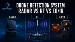
Counter-UAS Radar Vs RF Detection
Radar and RF detection are complementary.
Radar
Detects the physical aircraft.
RF Sensor
Detects compatible radio transmissions.
Radar can detect certain autonomous or RF-silent targets.
RF sensing can sometimes provide more information about:
- Communication protocol
- Controller
- Drone identity
Multi-sensor C-UAS architectures use these differences to improve coverage.
Counter-UAS Radar Vs EO/IR
Radar provides wide-area detection and tracking.
EO/IR provides visual or thermal confirmation.
Cameras generally cannot search large volumes as efficiently when zoomed in.
Radar can therefore act as the cueing sensor.
It detects the target and sends coordinates to the camera.
This makes track accuracy and latency essential integration metrics.
Why Is Multi-Sensor Fusion Important?
No single sensor modality reliably solves every UAS scenario.
DHS advisory material has specifically recommended using multiple sensor modalities because one modality is unlikely to detect all small-UAS targets under every circumstance.
A layered detection architecture can combine:
Radar → physical track
RF → communication information
EO/IR → visual verification
C2 → common operating picture
Fusion should reduce uncertainty rather than simply display more sensor icons.
What Is Sensor Fusion?
Sensor Fusion combines observations from several sensors to estimate whether they represent the same physical target.
Suppose:
- Radar Track 17
- RF Detection 4
- Camera Object B
all occupy compatible locations.
Fusion software can correlate them into one target.
Without proper correlation, a multi-sensor system may accidentally display one drone multiple times.
What Is Track Correlation?
Track correlation determines whether observations from different sensors belong to the same aircraft.
The software may compare:
- Position
- Time
- Velocity
- Trajectory
- Classification
Correct correlation is especially important when many drones operate simultaneously.
Otherwise, the C2 platform can overcount targets and confuse operators.
What Is A Common Operating Picture?
A Common Operating Picture combines radar, RF, camera, and other relevant data into one operational interface.
Instead of monitoring several independent screens, operators can see unified tracks.
A useful C-UAS picture may display:
- Position
- Altitude
- Speed
- Heading
- Target class
- Classification confidence
- Sensor source
The C2 layer should convert sensor data into actionable situational awareness.
Does Counter-UAS Radar Need A C2 Interface?
For most professional integrated systems, yes.
Radar data usually needs to flow into:
- Command software
- EO/IR systems
- Security platforms
- Airspace-management tools
Useful integration standards or interfaces may include:
- ASTERIX
- Ethernet/IP APIs
- Vendor SDKs
- Standard track messages
For example, current Weibel C-UAS systems specifically advertise ASTERIX output for C2 integration.
Why Is An Open API Important?
A closed radar may work well as a standalone sensor but become difficult to integrate.
An open or documented interface allows:
- Third-party C2 integration
- Camera cueing
- Data recording
- Analytics
- Future expansion
For long-life security projects, integration flexibility can be as important as current detection range.
Sensor technology changes faster than many infrastructure projects are replaced.
What Data Should A Counter-UAS Radar Output?
Useful radar track outputs can include:
- Track ID
- Timestamp
- Range
- Azimuth
- Elevation
- Latitude/longitude
- Altitude
- Radial velocity
- Estimated velocity
- Classification
- Confidence
- Track quality
The output should also define coordinate systems and timing clearly.
Poorly synchronized sensor data can reduce fusion accuracy.
Why Is Time Synchronization Important?
Sensor fusion compares observations from different systems.
If radar data and camera data use different timestamps, a fast drone may appear at different locations even when both sensors are correct.
Accurate time synchronization therefore improves:
- Track correlation
- Camera cueing
- Event reconstruction
- Multi-radar fusion
This is easy to overlook during hardware selection.
What Is ASTERIX?
ASTERIX is a standardized format used for exchanging surveillance information.
Some professional radar manufacturers use ASTERIX interfaces to deliver 3D target tracks to command-and-control systems.
For integration projects, standardized data formats can reduce custom engineering.
However, buyers should confirm which ASTERIX categories or message structures the specific product supports.
What Is Radar-To-Camera Cueing?
Radar detects and tracks a UAV.
The system converts that track into pointing coordinates.
An EO/IR camera then automatically rotates toward the estimated target location.
This is known as Slew-To-Cue.
Successful cueing depends on:
- Radar accuracy
- Latency
- Coordinate calibration
- Camera field of view
- Track stability
A long-range detection without sufficient angular accuracy may not produce reliable visual acquisition.
Should A Counter-UAS Radar Identify The Drone Model?
Radar can sometimes support UAV-type or class classification.
Exact model identification is much harder.
RF detection may identify specific communication characteristics when compatible signals exist.
Visual sensors may provide additional evidence.
A professional system should therefore distinguish:
Detection
Classification
Identification
rather than using these terms interchangeably.
Detection Vs Identification
Detection: Something is present.
Tracking: Where is it going?
Classification: What general type of target is it?
Identification: What specific target or identity is it?
These steps require increasing information.
A radar that detects “probable drone” should not automatically be described as identifying an exact model or operator.
Can Counter-UAS Radar Determine Threat Intent?
No.
Radar can observe physical behavior such as:
- Approach direction
- Speed
- Hovering
- Restricted-zone entry
But a sensor cannot directly know human intent.
The FAA similarly states that detection systems do not determine the intent or threat level posed by a UAS.
Threat assessment belongs to the wider operational and command process.
How Should A Counter-UAS Radar Manufacturer State Range?
A useful datasheet should state more than one number.
For example:
Instrumented Range: Defined
Detection Range: Defined UAV/RCS
Tracking Range: Defined
Classification Range: Defined
Minimum Range: Defined
Pd: Defined
Environment: Defined
This immediately makes the product easier to compare professionally.
What Information Is Missing From Many Radar Datasheets?
Common omissions include:
- Target RCS
- Pd at range
- Classification range
- Minimum range
- False-track rate
- Edge-of-sector performance
- Track latency
- Track-update rate at full load
- Target separation
- Site assumptions
These parameters often matter more than the marketing features placed at the top of a brochure.
Why Should Buyers Ask About Edge-Of-Coverage Performance?
Radar performance is not always uniform across its entire field of view.
For sector electronically scanned arrays, performance may change at large steering angles.
For rotating systems, nearby obstruction can affect particular directions.
Therefore, field testing should include:
- Center sector
- Intermediate angles
- Coverage edge
A single favorable flight path does not prove complete coverage.
Why Should Buyers Ask About Weather?
Counter-UAS systems are often expected to operate continuously.
Test conditions should therefore represent:
- Rain
- Wind
- Heat
- Cold
- Fog
- Dust
Radar is generally less dependent on visible-light conditions than cameras, but that does not mean all weather produces identical radar performance.
Environmental claims should be supported by stated test conditions.
Why Should Buyers Ask About EMI?
Radar transmits RF energy.
At airports and other RF-sensitive sites, electromagnetic compatibility can be an important deployment consideration.
The FAA’s current airport guidance specifically notes potential electromagnetic interference with communication and navigation equipment and requires appropriate coordination for airport installations in the United States.
Site RF analysis can therefore be part of professional deployment planning.
Is Detection-Only Radar Legally The Same As Drone Mitigation Equipment?
No.
Detection and mitigation should be separated both technically and legally.
Radar detects and tracks.
Mitigation may involve disrupting, disabling, controlling, or otherwise acting on a UAV.
Legal authority for mitigation varies significantly by country and application.
For U.S. airports specifically, the FAA currently distinguishes detection systems from mitigation systems and notes restricted authority for C-UAS mitigation operations.
Why Should A B2B Buyer Separate Detection From Mitigation?
The radar may be legal and appropriate for a site even when certain countermeasure technologies are restricted.
Separating the layers also makes the architecture easier to upgrade.
A project can specify:
Detection Layer
then:
C2 Layer
then, where authorized:
Response Layer.
This modular approach reduces the risk of choosing the entire system around one mitigation technology.
What Is FAT For Counter-UAS Radar?
FAT means Factory Acceptance Test.
Testing occurs before final site deployment.
FAT can verify:
- Hardware operation
- Interfaces
- Basic radar performance
- Track output
- Software functions
- Environmental features
However, a factory test cannot reproduce every characteristic of the customer’s actual terrain and clutter.
FAT should therefore be followed by site validation.
What Is SAT?
SAT means Site Acceptance Test.
The radar is tested at or under conditions representative of the real deployment location.
SAT is particularly important for Counter-UAS because performance depends heavily on:
- Buildings
- Terrain
- Vegetation
- RF environment
- Installation height
A radar that passes an open-field factory test may perform differently inside a port or refinery.
What Should Be Included In A Counter-UAS Radar SAT?
A strong SAT should include:
- Representative UAVs
- Different ranges
- Low-altitude flight
- Hovering
- Crossing trajectories
- Different approach angles
- Multiple UAVs
- Local bird activity
- Real clutter
- Coverage-edge tests
The objective should be to validate operational requirements, not create a demonstration optimized for the radar.
Should SAT Include Hovering Targets?
Yes.
Hovering represents one of the hardest common UAV conditions.
The drone should:
- Approach
- Stop
- Hover
- Rotate
- Move sideways
- Resume flight
The evaluator should watch whether the radar:
- Keeps the track
- Changes classification
- Drops the target
- Generates duplicate tracks
This reveals low-Doppler performance.
Should SAT Include Tangential Flight?
Yes.
A drone flying perpendicular to the radar can have low radial velocity.
This creates a different Doppler condition from a target flying directly toward the sensor.
Testing only head-on approaches may exaggerate real performance.
Multiple geometries should therefore be included.
Should SAT Include Small Drones?
Definitely.
Do not perform the entire acceptance test using one large industrial UAV if the project requirement includes consumer quadcopters.
Test the smallest realistic threat.
Record:
- Drone model
- Payload
- Altitude
- Distance
- Orientation
Where possible, representative RCS information should also be included.
Should SAT Include Birds?
If bird false alarms matter at the site, yes.
This is especially important around:
- Airports
- Ports
- Wetlands
- Coastal sites
- Agricultural areas
A system demonstrated during low bird activity may behave differently during migration periods.
Classification should be evaluated against the environment it will actually protect.
Should SAT Include Multiple Drones?
Yes, when multi-target or swarm performance is part of the requirement.
Do not simply spread every drone far apart.
Include:
- Close formation
- Crossing
- Different altitudes
- Group split
- Group merge
Measure track continuity and target count.
This is more meaningful than watching several icons moving independently across a screen.
What Metrics Should A Site Acceptance Test Record?
A useful SAT record can include:
| Metric | Purpose |
|---|---|
| Detection Probability | Reliability |
| Detection Distance | Warning range |
| Confirmed Track Distance | Usable range |
| Classification Distance | Target understanding |
| False Tracks | Operational workload |
| Track Update Rate | Responsiveness |
| Track Latency | Data freshness |
| Track Continuity | Stability |
| Position Accuracy | Sensor cueing |
| Target Count | Multi-UAV capability |
| Track Swaps | Association quality |
These metrics create a repeatable procurement decision.
How Do You Compare Two Counter-UAS Radars?
Use equivalent targets and conditions.
| Parameter | Radar A | Radar B |
| Test UAV | Same | Same |
| Target RCS | Same/Defined | Same/Defined |
| Detection Range | Measure | Measure |
| Stable Tracking Range | Measure | Measure |
| Classification Range | Measure | Measure |
| Minimum Range | Measure | Measure |
| Pd | Measure | Measure |
| False Tracks | Measure | Measure |
| Update Rate | Measure | Measure |
| Angular Accuracy | Measure | Measure |
| Multi-Target Performance | Measure | Measure |
Without standardized conditions, datasheet comparison is weak.
Why Should Buyers Avoid “Best Counter-UAS Radar” Lists?
There is no universal best radar.
A border site and prison may require completely different systems.
A military base and airport may also prioritize different:
- Ranges
- Elevation coverage
- Track counts
- Mobility
- Interfaces
A useful radar is one that matches the threat model + site geometry + required response time.
Generic rankings rarely capture these variables.
How Much Detection Range Do You Actually Need?
Start with warning time.
Suppose a representative UAV flies at:
20 m/s.
A 5 km approach would theoretically take roughly:
250 seconds, or about 4.2 minutes, if it flies directly toward the protected point at constant speed.
The project should determine how much time is required for:
- Detection
- Confirmation
- Assessment
- Operator response
Then derive the required operational range.
Is Longer Range Always Better?
No.
Additional range can provide earlier warning.
It can also produce:
- More irrelevant tracks
- Larger monitored airspace
- Greater processing demand
- Higher cost
A prison protecting a compact perimeter may not need the same range as a border-surveillance radar.
The useful question is:
How much reliable warning distance does the mission require?
Why Can Extremely Long Range Increase Operator Workload?
A longer-range radar can observe more airspace.
That may mean more:
- Birds
- Aircraft
- Legitimate drones
- Unknown targets
The detection system then needs stronger filtering and classification.
Long range without effective target management can increase operator workload instead of improving security.
How Should Airports Evaluate Counter-UAS Radar?
Airport deployment requires additional caution because the environment contains:
- Aircraft
- Birds
- Ground vehicles
- Navigation equipment
- Communication systems
The FAA’s current guidance recommends coordination before UAS detection deployment at U.S. airports and addresses electromagnetic interference, operational response, and aviation safety considerations.
See the FAA UAS Detection, Mitigation, And Response On Airports resource for current U.S.-specific guidance.
How Should Critical Infrastructure Choose Radar?
Start by mapping the facility.
Identify:
- Protected asset
- Site perimeter
- Building height
- Terrain
- Likely UAV approach directions
- Required warning time
- Sensor locations
Industrial sites frequently contain severe obstruction and multipath.
Several shorter-range radars positioned correctly may provide better coverage than one long-range sensor placed behind large structures.
How Should Border Projects Choose C-UAS Radar?
Border surveillance often prioritizes:
- Long-range coverage
- Wide sectors
- Low-altitude detection
- Multiple targets
- C2 integration
Terrain becomes particularly important.
Hills can block low-flying UAVs even when a radar has excellent theoretical range.
Deployment planning should therefore consider overlapping sensor sites and line-of-sight coverage.
How Should Mobile Counter-UAS Radar Be Evaluated?
A mobile system has additional requirements:
- Weight
- Power
- Setup time
- Mast height
- Stabilization
- On-the-move capability
- Network connectivity
A high-performance fixed radar may be unsuitable for rapid deployment.
Some current C-UAS radars specifically offer vehicle-mounted and on-the-move configurations.
Mobility should be tested under the customer’s actual deployment concept.
What Does On-The-Move Radar Mean?
On-The-Move, or OTM, means the radar can operate while installed on a moving platform.
This is more difficult than stationary operation.
Vehicle motion affects:
- Platform position
- Radar velocity
- Stabilization
- Clutter
- Track coordinates
The radar must compensate for its own movement before interpreting target motion correctly.
OTM performance should therefore be demonstrated separately.
What Is SWaP?
SWaP means:
Size, Weight, And Power.
These factors matter for:
- Vehicle systems
- Rooftop installation
- Portable C-UAS
- Remote locations
A radar with better nominal range may require much greater power and cooling.
The optimal product balances sensing capability with installation practicality.
Does A Counter-UAS Radar Need IP65 Or Higher Protection?
Outdoor radar needs environmental protection suitable for its deployment conditions.
Ingress-protection ratings can indicate resistance to:
- Dust
- Water
However, IP rating does not describe:
- Temperature performance
- Salt fog
- Vibration
- Shock
- Lightning protection
Military and harsh-environment applications may require additional standards.
Buyers should define the actual environmental qualification required.
Why Is Reliability Important?
C-UAS radar is often expected to operate continuously.
A product that performs well during short demonstrations but requires frequent maintenance can create real coverage gaps.
Useful reliability information can include:
- MTBF
- MTTR
- Maintenance intervals
- Spare-part strategy
- Remote diagnostics
Some current professional C-UAS products explicitly publish reliability and maintainability as system characteristics.
What Is MTBF?
MTBF means Mean Time Between Failures.
It is a statistical reliability metric used for repairable systems.
A larger number can indicate greater expected interval between certain failures under defined assumptions.
However, MTBF should not be confused with guaranteed product lifetime.
Field support and maintainability are also important.
What Is MTTR?
MTTR commonly means Mean Time To Repair.
A radar may have excellent detection performance but still create operational problems if a failed component requires weeks to replace.
For critical infrastructure or border projects, buyers should evaluate:
- Spare modules
- Remote diagnostics
- Local support
- Replacement time
System availability matters more than specification-sheet performance alone.
What Should A Counter-UAS Radar Manufacturer Provide Before Purchase?
A professional supplier should be able to provide clear answers on:
- Tested UAV/RCS
- Detection range
- Tracking performance
- Classification capability
- Coverage
- Update rate
- Interfaces
- Environmental limits
- Installation
- Testing methodology
The manufacturer should also be willing to distinguish theoretical, instrumented, and demonstrated performance.
That transparency makes project engineering easier.
What Should Be Included In An RFQ?
A useful Counter-UAS Radar RFQ should define:
Target Requirement
Representative UAV or RCS.
Detection Requirement
Required range and Pd.
Coverage
Azimuth and elevation.
Tracking
Accuracy and update rate.
Classification
Required target classes.
Multi-Target Requirement
Expected target density.
Environment
Weather and clutter.
Integration
C2/API requirements.
Testing
FAT and SAT criteria.
This produces much better proposals than asking suppliers for their “best radar.”
Example Counter-UAS Radar RFQ Requirement
Instead of:
“Need 10 km anti-drone radar.”
use:
“The radar shall demonstrate reliable detection and stable tracking of the defined representative UAV/RCS at the specified distance and altitude under representative clutter, while meeting required Pd, false-track, update-rate, accuracy, coverage, and multi-target performance.”
This forces proposals to address operational performance instead of only maximum range.
How To Evaluate A Counter-UAS Radar Manufacturer
Do not evaluate only product specifications.
Also consider:
- Radar R&D capability
- Signal-processing experience
- Manufacturing capability
- Integration support
- Field-test capability
- Customization
- Long-term software support
- Project engineering
Counter-UAS radar is not a commodity sensor.
Site adaptation and system integration can strongly affect actual results.
Should You Buy Radar Or A Complete C-UAS System?
It depends on your project.
Buy radar when:
- You already have a C2 platform
- You are a system integrator
- You need a specific sensor layer
- You require custom integration
Buy or develop a complete system when:
- You need unified sensor fusion
- You need EO/IR and RF integration
- You need centralized operator workflow
The procurement scope should be defined before comparing products.
Why Is Modular Architecture Important?
Drone technology changes rapidly.
A modular architecture allows future replacement or addition of:
- Radar
- RF sensors
- Cameras
- Software
- Other authorized components
Without modular interfaces, the customer may become locked into one supplier.
Open integration therefore improves long-term system flexibility.
Can One Radar Protect An Entire Site?
Sometimes.
But not always.
One radar may be sufficient for:
- Open terrain
- Compact facilities
- Simple coverage geometry
Several radars may be better for:
- Ports
- Refineries
- Urban sites
- Airports
- Large military facilities
where structures or terrain create coverage gaps.
System design should come before sensor quantity.
When Should Multiple Radars Be Used?
Consider multiple radars when:
- Buildings block line of sight
- Site size exceeds useful range
- Redundancy is required
- Swarm geometry is important
- Multiple viewpoints improve coverage
Overlapping coverage can improve track continuity.
However, multi-radar systems also require track fusion to prevent duplicate targets.
What Is Multi-Radar Fusion?
Multiple radars may observe the same UAV.
Fusion software combines those observations into one track.
It must consider:
- Position uncertainty
- Timing
- Radar location
- Coordinate systems
- Track IDs
Correct fusion can improve coverage and robustness.
Poor fusion can create duplicate tracks and confusing target counts.
Why Is Site Survey Essential?
A datasheet cannot show how radar will behave around your specific:
- Buildings
- Terrain
- Trees
- Towers
- RF environment
A site survey identifies:
- Installation locations
- Blind zones
- Coverage overlaps
- Power/network needs
- Camera positions
This frequently has greater influence on operational performance than a small difference in advertised maximum range.
What Is The Biggest Counter-UAS Radar Buying Mistake?
The biggest mistake is buying kilometers instead of capability.
A 15 km radar is not automatically better than an 8 km radar.
The more important questions are:
- What target?
- What Pd?
- What tracking quality?
- What classification?
- What false-track rate?
- What update rate?
- What coverage?
- What site?
Once these questions are answered, range becomes meaningful.
What Is The Second Biggest Buying Mistake?
Assuming:
Radar = Complete C-UAS.
Radar provides essential detection and tracking.
But a complete operational system may still need:
- Visual confirmation
- RF sensing
- Sensor fusion
- Threat assessment
- Operator workflow
The radar should therefore be selected as part of the complete architecture rather than as an isolated specification.
What Is The Third Biggest Buying Mistake?
Accepting demonstration results without defining test conditions.
Always document:
- Drone model
- Payload
- Altitude
- Range
- Flight direction
- Weather
- Clutter
- Radar configuration
Otherwise, a successful demonstration may be difficult to reproduce after installation.
How Is Counter-UAS Radar Technology Changing?
Current development is moving toward:
- Smaller AESA arrays
- Better micro-Doppler
- AI-assisted classification
- Sensor fusion
- Networked radar
- Improved swarm tracking
- On-the-move surveillance
- Software-defined processing
Government testing programs continue to evaluate C-UAS technologies under operationally relevant conditions rather than relying only on manufacturer claims.
Why Will Multi-Sensor C-UAS Become More Important?
UAV technology is becoming more diverse.
Future threats may include:
- RF-silent drones
- Autonomous UAVs
- Swarms
- Low-RCS aircraft
- Modified commercial drones
No single sensor observes every relevant characteristic.
Radar provides physical surveillance.
RF, EO/IR, and other sensors provide complementary information.
The future is therefore likely to emphasize sensor fusion rather than sensor replacement.
Conclusion
The best Counter-UAS Radar is not the system with the largest kilometer number—it is the radar that reliably detects, tracks, and helps classify the required UAV with acceptable probability of detection, false-track performance, accuracy, update rate, latency, and coverage in the real deployment environment.
Buyers should compare target RCS, detection range, stable tracking range, classification range, minimum range, Pd, false alarms, angular accuracy, update rate, track capacity, sensor integration, and field-test results together.
A professional procurement process should therefore move from:
“How far can your radar detect?”
to:
“What exact target can it reliably detect, track, classify, and output under the conditions my project actually requires?”
FAQ
What Is Counter-UAS Radar?
Counter-UAS radar detects and tracks unmanned aircraft using reflected radio-frequency energy and provides target information to operators or integrated security systems.
What Is The Difference Between Counter-UAS Radar And Drone Detection Radar?
The terms often overlap.
Counter-UAS Radar emphasizes use inside a broader C-UAS architecture, while Drone Detection Radar emphasizes the sensing mission.
Is C-UAS Radar The Same As An Anti-Drone System?
No.
Radar is normally one detection sensor inside a larger anti-drone or C-UAS system.
Can Counter-UAS Radar Detect RF-Silent Drones?
Yes.
Radar detects the physical aircraft and does not require an active control link.
Can Counter-UAS Radar Detect Hovering Drones?
Suitable systems can use micro-Doppler and other processing to maintain or classify hovering UAVs, although performance should be tested at the required range.
What Is A Good Counter-UAS Radar Range?
There is no universal range.
Required distance depends on target RCS, approach speed, site size, response time, and environment.
Is Instrumented Range The Same As Drone Detection Range?
No.
Instrumented range describes the radar’s range-processing envelope, while actual UAV detection range depends on target and conditions.
What Is The Difference Between Detection And Tracking Range?
Detection establishes that a possible target exists.
Tracking requires repeated measurements to maintain a usable trajectory.
Is Classification Range Usually The Same As Detection Range?
Not necessarily.
Detailed classification can require better SNR and more target information than initial detection.
What Does Pd Mean In Radar?
Pd means Probability of Detection and describes how consistently a defined target is detected under specified conditions.
Why Does False Alarm Rate Matter?
Excessive false alarms increase operator workload and can reduce trust in the system.
False-track rate is particularly important in operational surveillance.
What Is The Best Frequency For Counter-UAS Radar?
There is no universal best frequency.
S-, C-, X-, Ku-, and millimeter-wave bands can all be used depending on mission requirements.
Is AESA Better For Counter-UAS?
AESA offers flexible electronic beam steering and target revisits, but actual performance still depends on antenna size, power, processing, target RCS, and environment.
FMCW Or Pulse Doppler: Which Is Better?
Neither is universally better.
They offer different engineering tradeoffs and should be compared using actual target-specific performance.
How Many Drones Can C-UAS Radar Track?
Capacity depends on radar architecture and processing.
Maximum track count should be evaluated together with minimum target separation, update rate, latency, and track continuity.
Can One Radar Detect A Drone Swarm?
Yes, but resolving individual members inside a dense formation is harder than simply detecting that a group is present.
Should Radar Be Combined With RF And EO/IR?
For many high-security projects, yes.
The technologies provide complementary information and can improve situational awareness.
What Should A Counter-UAS Radar Datasheet Include?
At minimum, ask for target/RCS, detection range, tracking range, minimum range, coverage, accuracy, update rate, track capacity, classification capability, environmental limits, and interface information.
What Should Be Tested Before Buying?
Test representative drones, hovering, crossing flight, low altitude, multiple directions, local clutter, birds where relevant, multiple UAVs, and sector-edge coverage.
What Is FAT?
FAT means Factory Acceptance Test and verifies system functions before final site deployment.
What Is SAT?
SAT means Site Acceptance Test and verifies operational performance under representative deployment conditions.
How Do I Choose A Counter-UAS Radar Manufacturer?
Choose based on demonstrated target-specific performance, radar engineering capability, integration support, field-testing capability, manufacturing quality, and long-term technical support rather than maximum range alone.